Riverbank (Riparian) Diorama
Riverbank (Riparian) Diorama
|
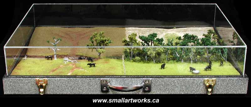
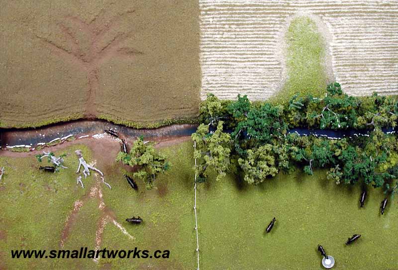
The overhead view photograph below shows how the model is divided into quarters, demonstrating the different ways that pasture and crop land can be managed, both poorly and correctly. Before reading the explanation below, can you tell which is which and why? |
|
If you've even guessed a part of the explanation, then the model has done much of it's job. If you've not figured it out, then that's OK too, because that's why the model was built, and why there is an explanation that goes with it! I'm a just a modelmaker, not a farmer or a scientist, so it all had to be explained to me in detail before I could even build the diorama! So,
here comes the educational part!
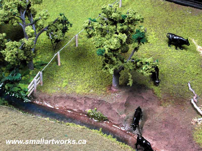
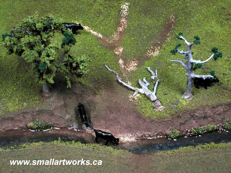
You need to refer to the overhead photo above when reading the following: The top left quarter represents poor crop management. This simulates land that was cultivated without leaving grass stubble behind. When the earth is left bare, rain will erode away the soil causing gulleys and drainage ditches to form, carrying away valuable topsoil needed to grow the crops. Also, because the land is cultivated right up to the river's edge, there is nothing to keep the water from eroding away the riverbank causing much of the bank and the farmland itself to be carried away by the encroaching river. The top right quarter of the picture represents crop land that is properly managed with respect to a riparian area. There is stubble from the cultivated crop deliberately left in the field which helps to hold the soil together and keeps the rain from washing it away. The green area in the middle is not farmed. Instead grass is allowed to grow there, helping to hold the surface together so that gulleys do not form which would carry the soil into the river. The trees and assorted large vegetation along the riverbank helps keep the water's current from eroding the land away. The lower left quarter represents pasture land (where cattle graze) that has been poorly managed. The area has been severely overgrazed, allowing the rain to wash away much of the land in the form of gulleys, exposing the gravel and rock underneath. Most of the trees have died or have been cut down, so there are no tree roots that act as a "glue" to hold the bank together so valuable land is simply washed away by the moving water. Because no artificial water supply has been supplied, the cows have no choice but to meander down to the river to get a drink. This activity smashes up the river bank causing further erosion and dumping of earth and pollutants into the water. Sometimes as much as fifteen feet of bank can be lost in a single year as a result! The lower right quarter of the model shows a section of pasture land that is properly managed. By rotating cattle from field to field, overgrazing does not occur because the grass has a chance to grow back. By supplying a large water trough placed away from the river for the cattle to drink from, the cows therefore do not destroy the riverbank or pollute the water. The trees along the bank prevent erosion as well. The purpose of the model was to explain these facts. The point made is that with proper forethought and land management, farming need not be detrimental to the environment and will actually yield more productive and efficient land and greater profits for the farmer! Below are some closeups of the model, showing the more subtle details. |
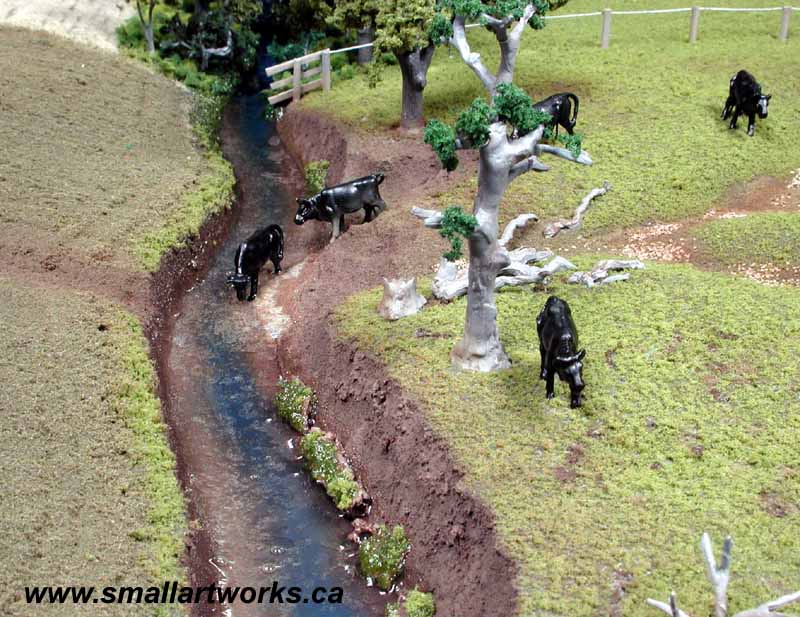
Here we can
see how erosion of the riverbank takes place, with large chunks of land
sliding down
into the stream as the water encroaches on the bank washing away supporting
earth.
The river's
water flow runs from the good areas into the poorly managed areas.
Cows come down
to the river in the poorly managed pasture area for a drink in polluted
water, destroying
the riverbank
in the process.
Environmental
damage can be avoided simply by providing an artificial water trough for
the cattle
in a location away from the riverbank.
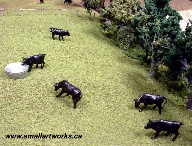
Little "in-joke"
here... The water trough is actually an upturned engine bell from
a 22" Eagle
spacecraft model shown elsewhere in the Small Art Works website...
It just happened
to be the right size and shape!
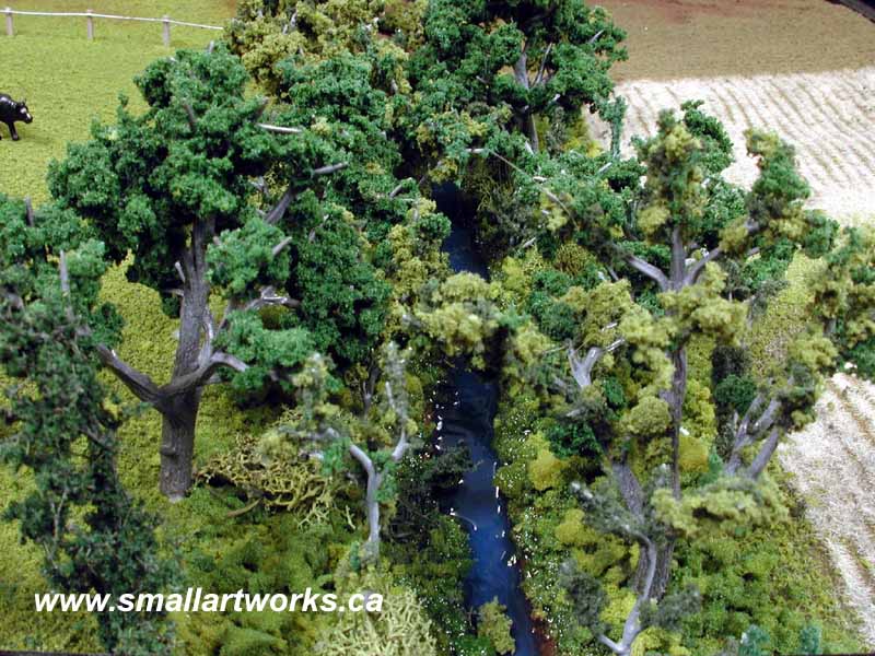
The exaggerated
blue colour was added to the water to make it stand out a bit more than
it would in reality.
Although a
certain degree of realism was intended, sometimes for demonstration purposes
it is necessary
to "cheat"
with a model if it helps to explain the point better.
|
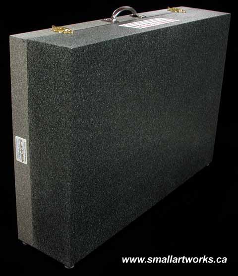
The model was built to be as light as possible so it could be carried from place to place easily. The diorama is permanently mounted to the scratch-built custom case bottom, and the custom made lightweight plastic shroud can be affixed to the top for protection of the removeble clear plexiglass cover during transport. Handle, latches and "feet" were applied to the case. |